 |
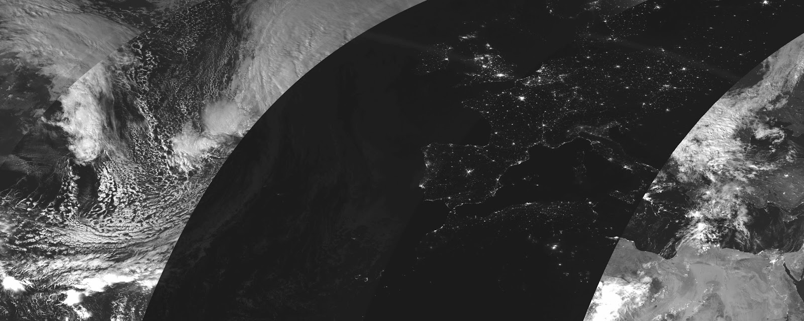
| Image and Data processing by NOAA's National Geophysical Data Center, cropped and enhanced by me. This image can be used with credit to NOAA and me. |
Blogger has limits on the image size, so you probably want to see this higher resolution version (the full resolution version is hundreds of Mb, if you want to download it you can for the next two weeks here).
When the moon is full, Suomi can see clouds and land extremely well, and oceans and lakes appear extremely dark. The brightest spots are artificial light from human settlements. For example, check out this zoom in of the Nile delta, Israel, and the Gulf of Suez from the same image:
 |
| Image and Data processing by NOAA's National Geophysical Data Center, cropped and enhanced by me. This image can be used with credit to NOAA and me. |
Nearly a year ago I posted an image of a lunar eclipse over North America that is maybe even cooler because of the different gradient in moonlight.
No comments:
Post a Comment